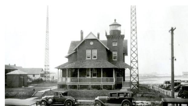
When you use your phone or car-based GPS, remember the Sea Girt Lighthouse.
When the Sea Girt Light Station was illuminated on December 10, 1896, it completed the coverage of the Jersey Shore. The L-shaped red brick building covered the dark gap of coast between the Navesink Twin Lights and Barnegat Light.
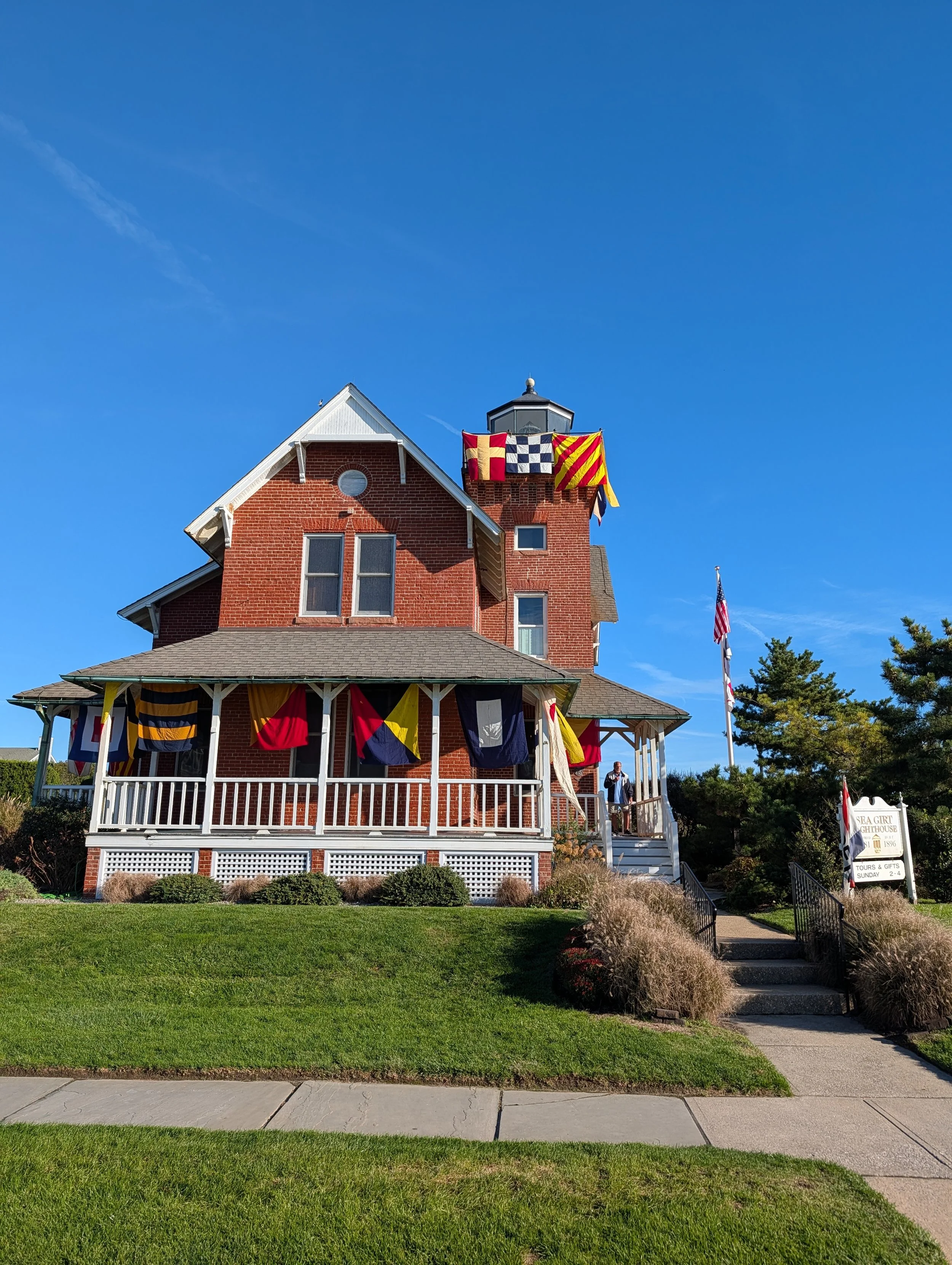
The Sea Girt Light in full regalia
Sea Girt’s 42-step tower with keeper’s quarters was the last residential "live-in" or "integral" L-shaped brick lighthouse built by the US Lighthouse Service on the Atlantic coast. The beacon, with its 4th-order Fresnel lens and its unique flash, gave ships a bearing from as far as 15 miles out to sea.
NAVIGATION’S ORIGINS
For thousands of years, mariners used several techniques to navigate. Wayfinders in Micronesia and Polynesia used mental maps. Sea clues like current and wave formations, clouds, and birds allowed them to populate the islands of Oceania. Wayfinders led massive migrations in great sailing canoes. The Vikings used similar techniques to venture far from their Norse settlements.
Song Dynasty Chinese sailors invented the magnetic compass in the 11th century. They later developed star maps and a series of sticks for celestial readings, allowing them to sail as far as Africa.
European sailors from the 1500s were also using the stars. By the 1700s, sextants and eventually chronometers (clocks) on board were used to fix definitive lines of longitude and latitude. They triangulated on maps to mark their position more accurately than had ever been accomplished.
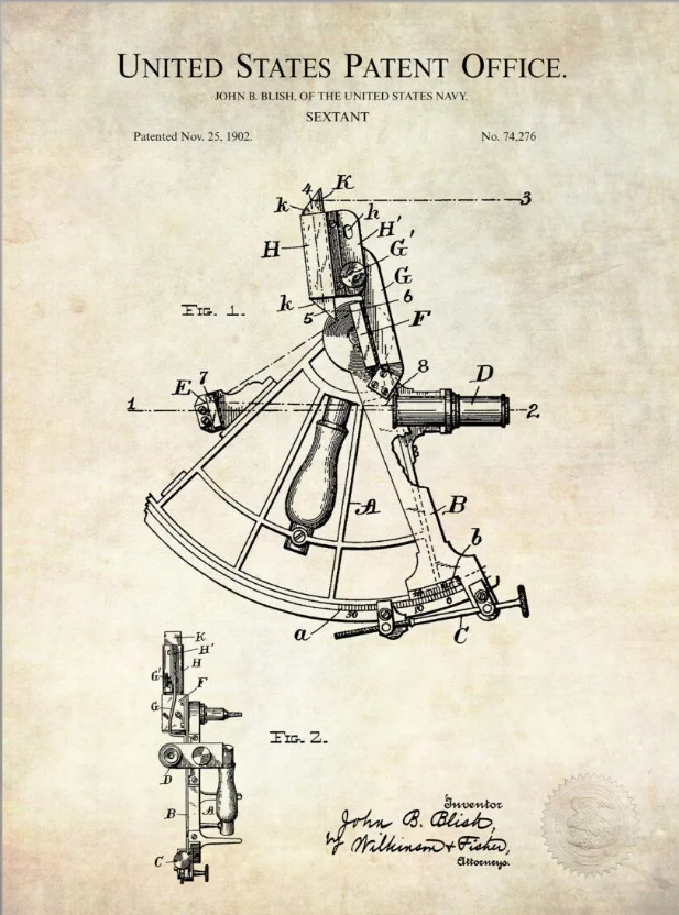
1902 patent for a sextant. Celestial readings guided ships for centuries
Waves, wind, and clouds still made their location a rough estimate on moving ships. Lighthouses were positioned to extend visual range, to help captains avoid hazards, and locate harbor entrances.
The Pharos of Alexandria guarded the entrance to the Nile for 1,500 years from 230BC. Boston Light, 1716, was the earliest in North America, and Sandy Hook Light initiated service in 1764.
FROM SIGHT TO WIRELESS
Guglielmo Marconi invented the wireless radio in 1896. In 1899, radio telegraph was used to broadcast the results of the America’s Cup Race at Sandy Hook from a station at Twin Lights. A year later, Marconi sent a message from Cornwall to St. John’s, Newfoundland, proving that radio waves would bounce off the ionosphere. Ships began to use “the wireless” to communicate, assigning “sparks”, men proficient in Morse code. Radio was credited with saving over 700 lives when the Titanic sank in 1912. It became mandatory equipment on large passenger ships.
World War I triggered the widespread implementation of Marconi’s wireless telegraph radios on military ships and into the field of war.
Navigation was still limited to lines of sight. In a storm, when it was needed most, captains had trouble fixing a position. They were limited by visibility of the shore, a level horizon, and the heavens.
As the war ended, Marconi’s company led experiments in the non-military use of the radio. Starting in 1912, he purchased 37 acres in Wall Township at Camp Evans for a cross-Atlantic communications center. Radio had become cutting-edge technology.
A key invention was a loop antenna, which rotated around a central axis. It could be used to detect the origin of a radio signal. Spin the antenna and the operator could hear a signal to identify a land-based tower. When the position lined up behind the loop, the signal went silent as the electromagnetic waves went null, cancelling each other out, and marking the location of the transmitter.
The US Lighthouse Service suggested an experiment. They would build radio towers at Sea Girt, the Fire Island light ship, and on the Ambrose light ship, a floating channel marker, positioned in 1908 to point captains to the newly dug Ambrose Channel, and the Narrows between Staten Island and Brooklyn, NY.
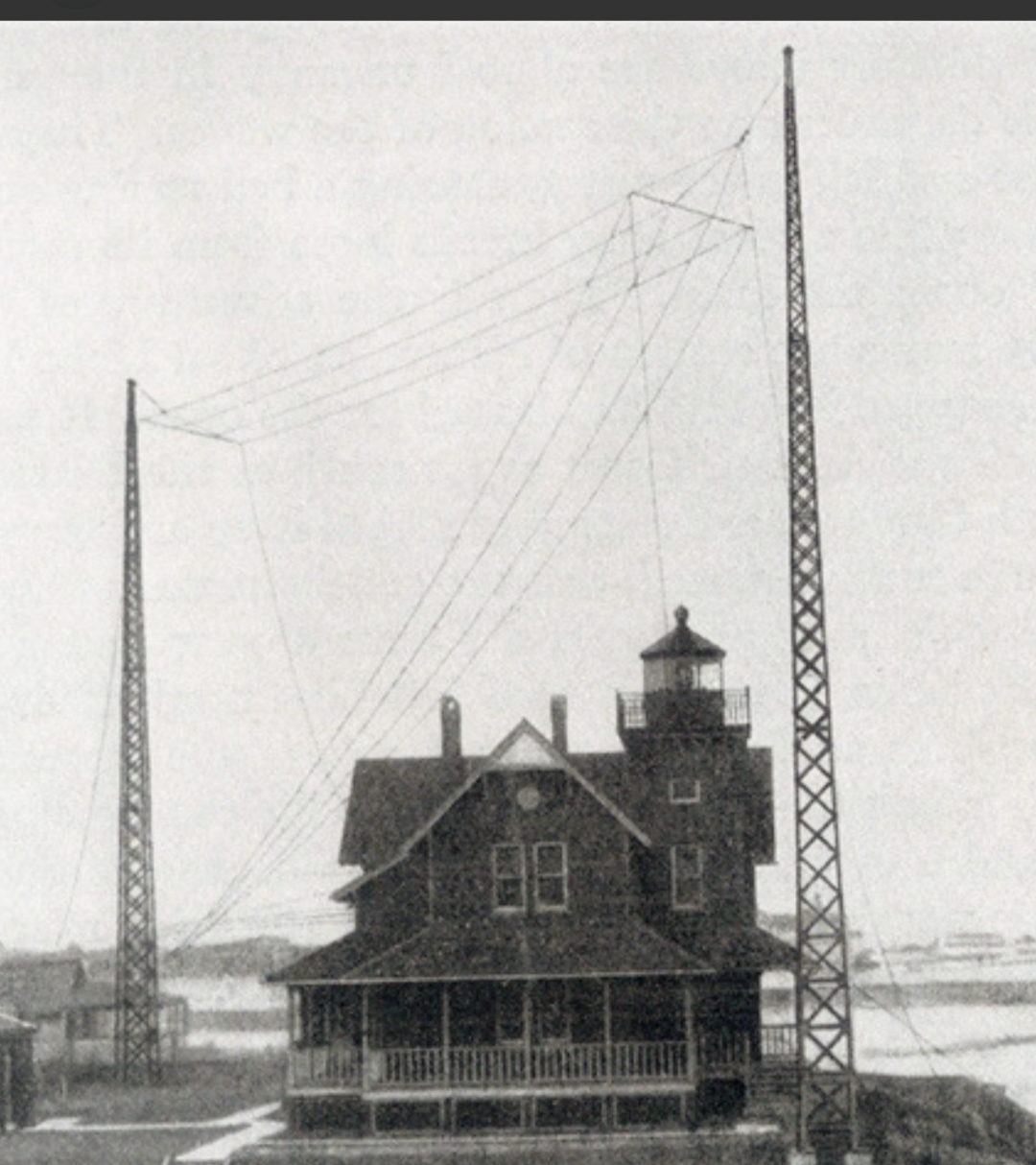
The radio towers from the early 1920s. They came down in 1928
The three towers would send a unique signal. Ambrose used single dashes. Fire Island, double dashes. Sea Girt, triple dashes. In the radio room, by tuning to null, sparks could fix a line to each tower, and then with a ruler, triangulate their position.
The world’s first practical application of navigation without sight came online in May 1921. It was a crude precursor to GPS, at the time called “Radiogoniometry”. Ships could fix their position with far better accuracy, regardless of the weather, light, or seas. Sea Girt’s beacon sent radio waves over 200 miles out into the Atlantic. Keeper William Lake had to maintain the transmitter and the towers, including keeping local children from climbing.
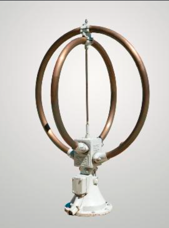
Warmuseum.ca photo of loop antenna
The system was quickly copied at other US ports, with foggy San Francisco Bay being the second facility to come on line.
The success of the 1921 trials at Sea Girt was a key step in the transformation of global navigation. Within a decade, radio beacons were installed along coasts worldwide. The experimental towers were removed from the beachfront in 1928, and the signal was relocated to the Barnegat lightship.
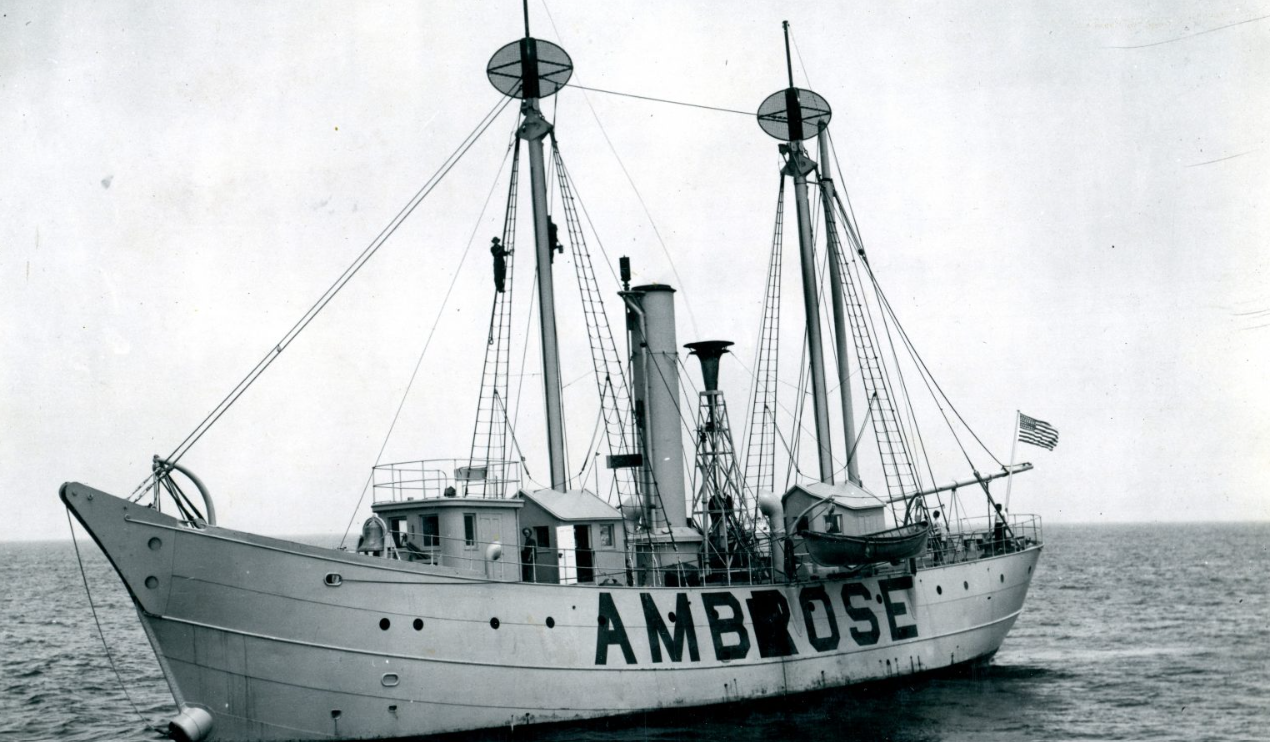
The Lighthouse service invested in lightships in the early 1900s. Long time Sea Girt Keeper William Lake worked the Fire Island lightship early in his career.
GOING OFFLINE
Electronic signals slowly eliminated the major role lighthouses once had in navigation. It was the beginning of the end for manned towers with kerosene lamps and Fresnel lenses.
As World War II approached, the Coast Guard took command of many lighthouses around the country. Coastal patrols bivouacked in the house at Sea Girt. In early 1942, the beacon was put out to avoid giving clues to enemy U-boats, as part of a coastal blackout.
The analog ancestor of GPS, which started at the last residential lighthouse on the Jersey coast, was refined many times. WWII introduced Loran, a low-frequency, long-range radio system that lasted in various forms until 2010. The military eventually took location services into space. GPS was made commonplace after satellite access was opened to public commercial use by turning off Selective Availability in 2000.
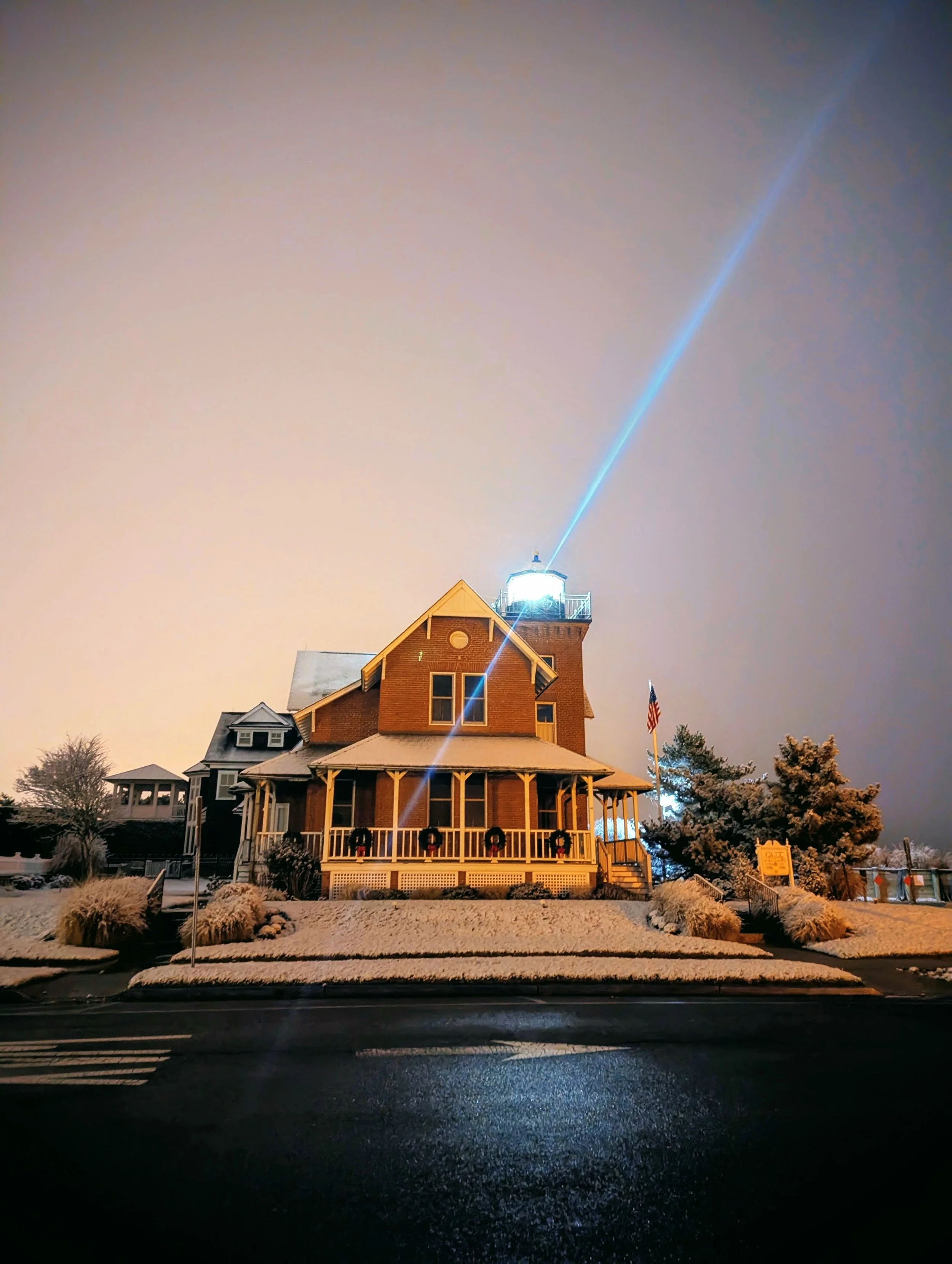
The light is no longer used for navigation, other than a visual cue for local sailors…Take note Larry.
The Sea Girt lighthouse has persisted through the full spectrum of ship navigation. It serves as a landmark for local craft (except for wayward Larry in the Alestorm).
Since the 1980s, it's been a museum, open on Sundays for lighthouse enthusiasts. The Sea Girt Lighthouse Citizens Committee, a 501(c)(3), leases the property from the Borough and maintains and operates the lighthouse.
Set your GPS to 9 Ocean Ave. Sea Girt NJ or 40.13666° N, -74.02746° W